
Categories: Tutorials
Lynda - Creating a Map with Illustrator
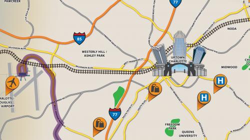
Learn to create a custom map that provides clean and accurate directions and points out the landmarks you want to highlight. In this course, William Everhart shows how to build a road map in Adobe Illustrator, which you can then print or embed on a website. Discover how to obtain a source image; trace the map; draw and style different roads, landmarks, and basic geographic features; and label your map with type and symbols. Finally, learn to add turn-by-turn directions and prepare your map for print or sharing online.
Table of Contents


Related Posts
Information
Members of Guests cannot leave comments.
Top Rated News
- Sean Archer
- AwTeaches
- Learn Squared
- PhotoWhoa
- Houdini-Course
- Photigy
- August Dering Photography
- StudioGuti
- Creatoom
- Creature Art Teacher
- Creator Foundry
- Patreon Collections
- Udemy - Turkce
- BigFilms
- Jerry Ghionis
- ACIDBITE
- BigMediumSmall
- Boom Library
- Globe Plants
- Unleashed Education
- The School of Photography
- Visual Education
- LeartesStudios - Cosmos
- All Veer Fancy Collection!
- All OJO Images
- All ZZVe Vectors
